Best for
- Lawns up to 1,000 m2
- Steep slopes up to 55%
- Triple-fusion navigation
SpecsLib adapts language, currency and estimated prices to your context.
Language
Country and currency
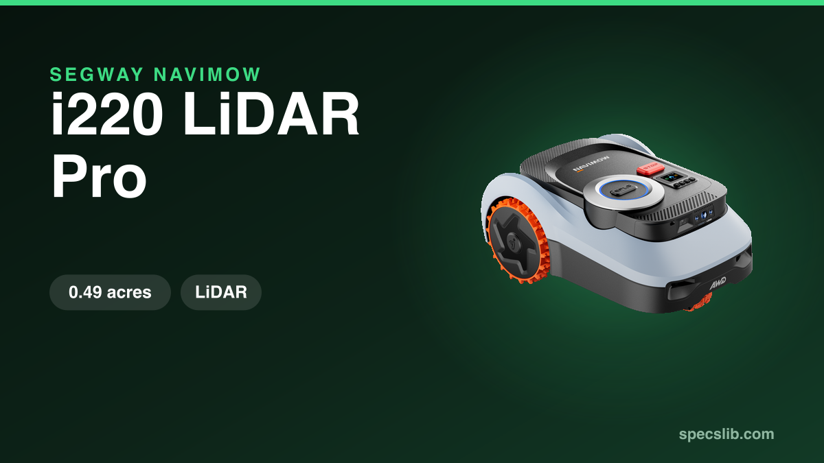
The Navimow i210 LiDAR Pro fuses LiDAR, Network RTK and vision with AWD off-road wheels to target 1,000 m2 and slopes up to 55%.
Specs verified on
Not sold in the United States
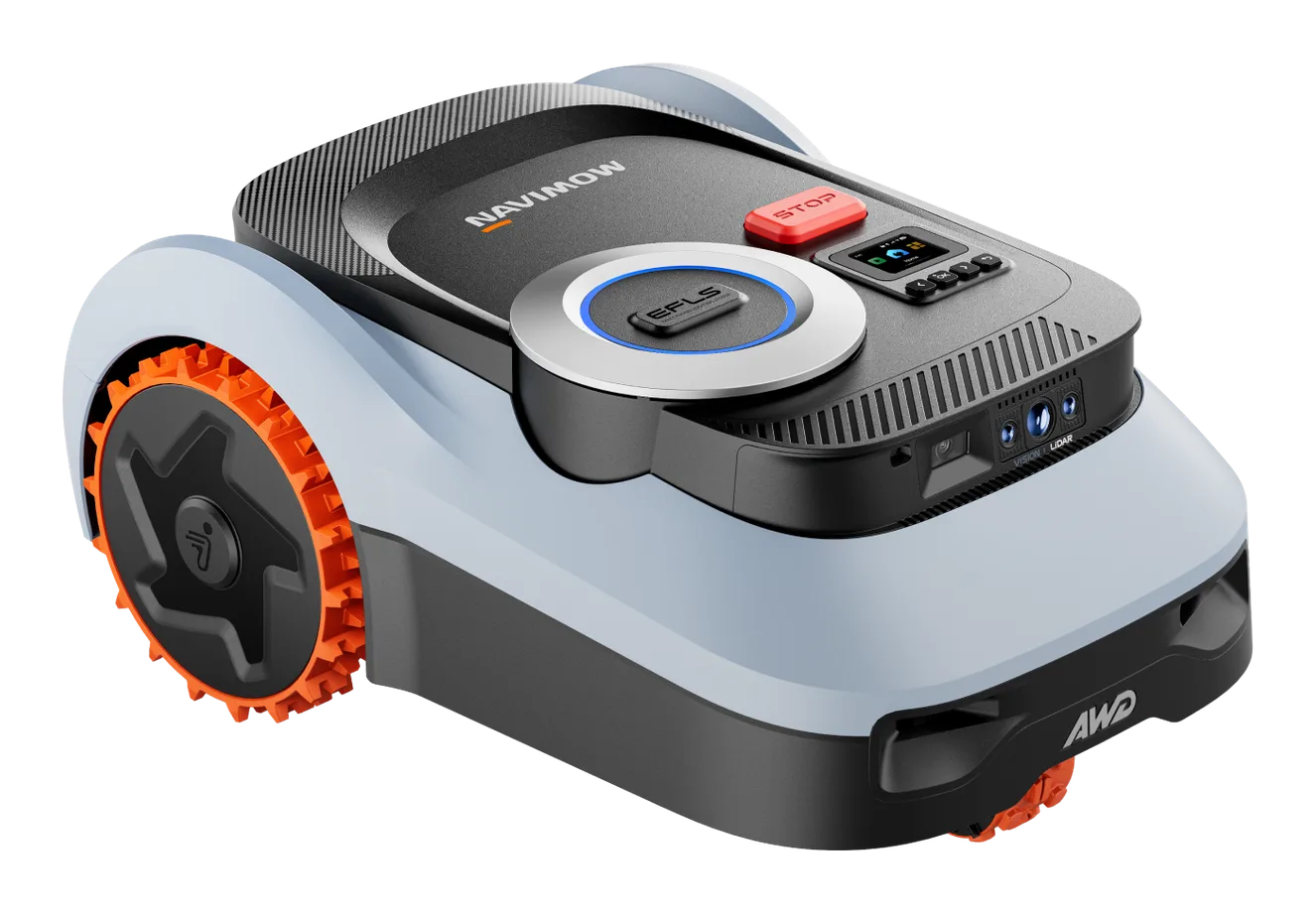
Triple-fusion navigation praised by five independent tests and a 55% slope rating confirmed on the ground, provided you accept edge cutting that leaves a few centimeters of grass and runtime that varies by tester.
These indicators are computed by SpecsLib from official manufacturer specs. They do not appear as such in any brand's documentation.
Square feet covered per euro spent. The higher the ratio, the better the area-to-price value.
Normalised score based on the declared maximum slope (55%). 100 = mechanical limit, 0 = flat ground.
Underlined terms open a plain-language explanation of navigation, detection and ecosystem technologies.
What the brand promises, what independent tests actually found, and the limit to plan around.
A solid-state LiDARLiDARLaser distance sensing used for mapping and detection., a wide-angle camera and satellite positioning replace the wire, the antenna and the reference station.
The two French tests of the i208 LiDAR, which carries the same sensor trio, both confirm setup with no wire and no antenna, and disagree about the edge. Presse-citron measured roughly 5 cm on flat surfaces and 10 to 15 cm against a wall or dense planting, and never had to free the mower by hand. Clubic reports about 20 cm from hedges in normal mowing and up to 40 cm once the edge modeEdge cuttingHow close to a wall or an edge the mower cuts, measured in centimetres of grass left. margin is added, and treats strimmerSide trimmerString cutting head mounted on the side, mowing past the deck and up to the boundary. work as permanent.
They agree on one thing: automatic mappingMappingBuilding the map of the garden the mower uses to plan its passes. is only worth trying on a simple garden, otherwise map by hand. Presse-citron also saw the wheels slip on waterlogged ground.
Sources: Clubic (FR) : test Segway Navimow i208 LiDAR, Presse-citron (FR) : test Segway Navimow i208 LiDAR
Five independent tests of the Segway Navimow i210 LiDAR Pro (PC-WELT and Basic Tutorials in Germany, PCtipp.ch in Switzerland, cedric.fm in Belgium and TechRadar in the UK) agree on setup without a boundary wire or RTK antenna judged simple and fast, and triple-fusion LiDAR plus Network RTK plus vision navigation judged precise and stable. On the claimed 55% (29°) slope, only PCtipp.ch actually exceeded it on the ground, deliberately, up to over 70%: the mower still climbs with good grip in a straight line, but a lift-safety sensor stops the mow out of caution when turning (a drive slip control setting in the app can push this limit further). PC-WELT confirms good handling on a more modest real slope, about 27%. cedric.fm reports good traction on its own slopes, which it states as "35-40°" (well beyond the 29° its own spec table lists as this same mower's maximum, an inconsistency the article doesn't explain). TechRadar and Basic Tutorials, meanwhile, repeat Segway's claimed 55% figure without testing it themselves. All five testers cite an identical 22 cm cutting width, but none presents it as an instrument measurement: the figure, absent from Segway's official spec sheet, likely comes from the same technical press kit. On runtime, PC-WELT measures about 68 minutes of mowing for 176 m2 on its own lawn (against a claimed 75 minutes and 195 m2), and Basic Tutorials confirms a close real-world range, 65 to 75 minutes for 175 to 195 m2; PCtipp.ch reports a notably longer runtime, about 100 minutes, with no source explaining the gap between the three. On its own lawn of just 170 m2, TechRadar twice failed to finish mowing on a single charge in the 'precision mowing' setting, returning to the dock with 4% of the lawn left and 15% battery before an 80-minute top-up charge; the reviewer itself notes Segway's claimed 1,000 m2 applies to a full 24-hour mowing cycle with recharge stops in between, not a single charge; notably, Basic Tutorials' own spec table separately lists a "daily output" of 1,700 m2/24h, with no source reconciling how either figure should be read. On edge cutting, PC-WELT praises navigation that follows detected edges precisely, but puts the uncut grass around fixed obstacles like a sun umbrella or a planter at about ten centimeters; Basic Tutorials separately confirms edge cutting is limited by the deck's fixed central position, and TechRadar measures it at about 7.5 cm (three inches) along solid borders. On small-object detection, the two outlets disagree: TechRadar saw the mower successfully avoid a dog toy and a small rubber ball, while Basic Tutorials judges detection not 100% reliable on small, flat objects like a tennis ball. PC-WELT and Basic Tutorials both judge the mower bulky for narrow passages (65.5 x 44.5 cm as stated, though PC-WELT doesn't claim to have measured this itself, unlike its own weight measurement of 17.35 kg), and each separately report a mandatory firmware update on unboxing taking about 10 minutes. 4G connectivity and theft protection are free the first year, then billed at about EUR 29.90/year (CHF 30/year per PCtipp.ch), a figure independently confirmed by PC-WELT, PCtipp.ch, cedric.fm and Basic Tutorials. Each test also reports isolated points the others don't confirm: cedric.fm notes wheels that get dirty quickly on wet ground and automatic mapping judged disappointing on a complex garden, while giving two inconsistent durations for its own manual mapping (about 15 minutes in one place in the article, 30 to 40 minutes in another for a comparable property). The price also diverges by tester and market: EUR 1,599 for cedric.fm, matching the current official price on Segway Europe's store, a close range from PCtipp.ch (about CHF 1,529) and TechRadar (GBP 1,399 in the UK, USD 1,399 in the US, but EUR 1,599 stated for Europe by that same source); Basic Tutorials states EUR 1,399 as the public price at the time of its test without saying whether this was a temporary discount; PC-WELT states no price at all. The unit cedric.fm tested came from Navimow Belgique for an unrelated radio segment, with the author stating the article itself isn't sponsored; none of the other four testers states where its unit came from.
What public reviews and owner feedback most often praise.
Consolidated watchouts identified by SpecsLib to help evaluate fit for your lawn and budget.
Our summary of each published test, with the link to read it.
It is designed to mow up to 0.25 acres (10,764 sq ft).
This model can handle slopes up to 55%.
No, this model operates without a wire (virtual navigation).
According to the SpecsLib calculation, the Segway Navimow i210 LiDAR Pro delivers 7 sq ft/€. Square feet covered per euro spent. The higher the ratio, the better the area-to-price value.
SpecsLib assigns a slope score of 55/100 (Good) to the Segway Navimow i210 LiDAR Pro. Normalised score based on the declared maximum slope (55%). 100 = mechanical limit, 0 = flat ground.
This model is not sold in your market. These mowers from the same brand are.
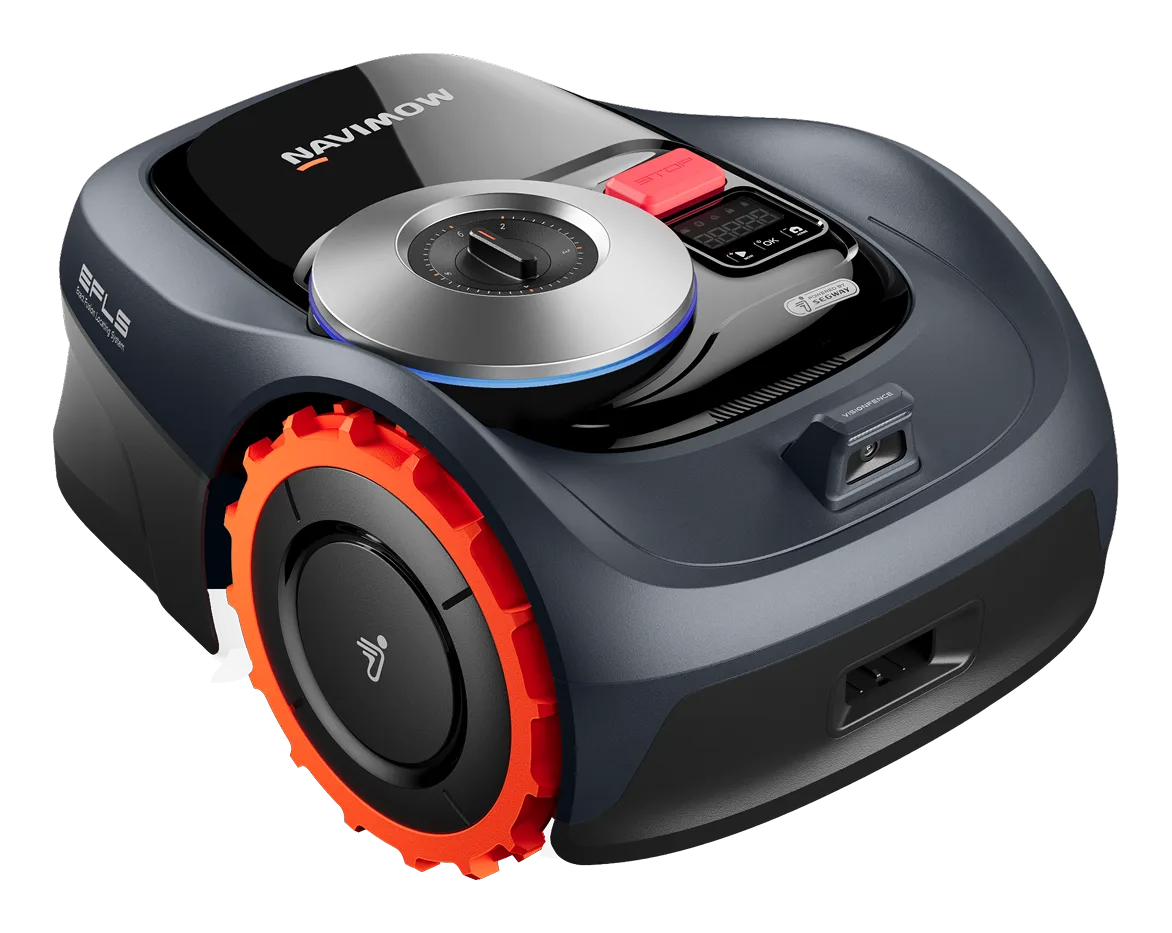
Navimow i110 expands the i105 formula for medium lawns while keeping the same friendly app-led setup.
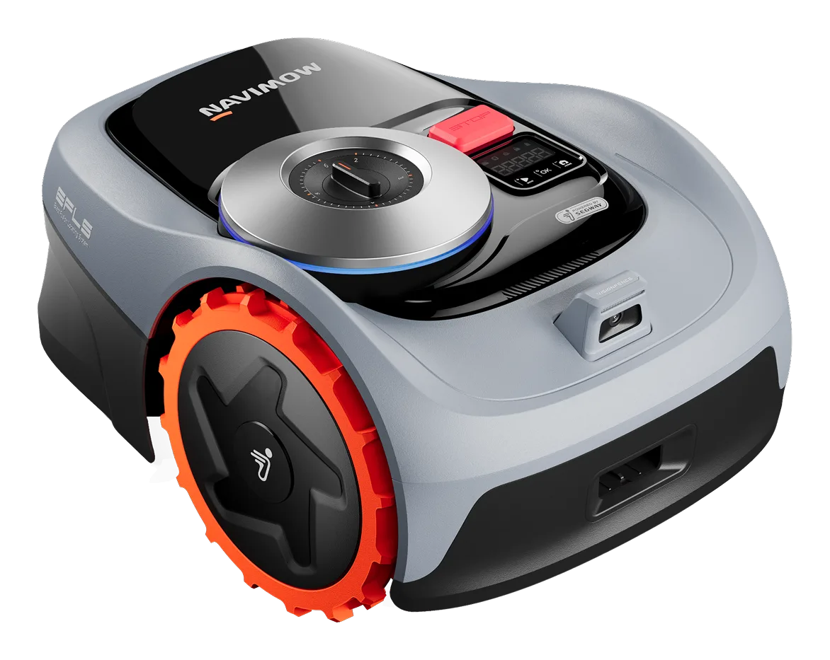
Navimow i105 is designed for smaller lawns with guided wire-free setup and accessible pricing.
Cross-checked testing and news that cover this exact mower.
Latest verification of official and technical sources.